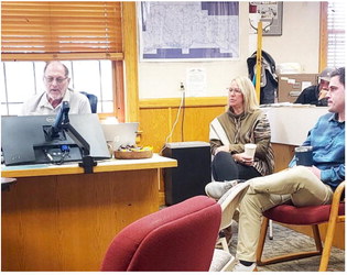
NWSG Says Flooding Possible In Coming Weeks
Light snow is falling across the region amid 20 degree temps at press time Tuesday morning. National Weather Service Glasgow meteorologist Brandon Bigelbach told the Northern Plains Independent that significant accumulations over half an inch are not expected with this round of precipitation.
He added that area residents should prepare for moderate flood stage conditions coming up in the next few weeks.
“If you live near the river, tend to low lying areas,” Bigelbach said. “Now is the time to prepare.”
Bigelbach said temps will come up rapidly by Friday, with 50 degrees possible by the weekend.
As temperatures start warming up over the next week, look for creeks, streams and rivers to rise significantly as the snow begins to melt. Bigelbach said flooding is most likely to occur in the Glasgow area but said the impacts will be felt region wide.
“None of the river gauges are up at this point,” said Bigelbach. “But snow melt accumulation will melt into the rivers and streams.”
Fog across river valleys may occur during the morning hours as we move into the weekend.
Bigelbach recommended that readers check in regularly with NWSG social media pages for conditions and weather information. You can also call 406-228-4042.
Some concern has arisen following the release of a graphic produced by NWS that mentioned the Milk River Basin having 334 percent of normal Snow Water Equivalent on the ground.
NWS noted that the data that produced this value of SWE percent of normal comes entirely from a single mountain SNOTEL site in the Bear’s Paw Mountains, south of Havre. In that area of the mountains, there is currently just over 10 inches of snow water equivalent in the snowpack. For that site, that is climatologically 334 percent of normal for this time of year.
However, the vast majority of the plains area that directly feeds the Milk River, which would be NWS’s concern for flooding potential, there is on average 2-4 inches of SWE. For this time of year that would be closer to 100 percent of normal, not over 300 percent. It will be possible that when the mountain snow does melt off the Bear’s Paw, that it will filter into the Milk and eventually make its way down to Glasgow.
The expected rapid warmup this weekend across the area means the snow that is on the ground is expected to melt quickly and would likely be almost all runoff, with little infiltration. This is what is leading to NWS’ more immediate flooding concern along the Milk River, and is what has led the River Forecast Center to predict over 90 percent chances for minor flooding, ~50 percent chance for moderate flooding and around a 10 percent chance for major flooding along the Milk River between Tampico and Nashua.
Monday, April 3, the Mc-Cone County Sheriff’s Office warned residents and recreationists who were at the north fork of Rock Creek on Fort Peck Lake that they’d received notice that North Rock Creek Road road might was out. Its status was unavailable as of presstime.


